Explore the states, locate their capitals, and follow the year overhead. Compare population, geography, and everyday reference facts. Every value names its source and date.
Planting dates depend on location. Local NOAA freeze normals and USDA reuse terms must clear the Almanac’s source standard before a planting window is included.
Territory insets are navigational and not to scale. The grid belongs to this map projection and remains fixed across editions; a changed projection requires a new grid version.
50 matching places
One category · fifty states
State register
Choose a heading to sort. Open Sources beside a state to inspect its citations and dates.
U.S. Senate, Alabama: States in the Senate timeline · Federal institutional history; this is a secondary reference to the act, ratification, or proclamation establishing statehood, not the enrolled act itself.
U.S. Bureau of Economic Analysis · 2025 annual gross domestic product in current U.S. dollars; not adjusted for inflation.What this measures
Annual nominal GDP · current U.S. dollars
The value added by production of goods and services within this jurisdiction during the stated calendar year, measured in that year’s dollars.
Not adjusted for inflation; not personal income, a quarterly annualized figure, or purchasing-power-parity GDP. Intermediate inputs are not counted again as new output.
Recorded value: 339,035,100,000 current U.S. dollars Producer status: estimate
2025 · current dollars BEA annual state GDP update 2026-09-30 · released Last successful check:
Land and water included in the Census area measurement for this jurisdiction.
Not land area alone. This retained statistical table uses 2010 boundaries and is not a new measurement made on the check date.
Recorded value: 52,420 square miles Producer status: retained statistical measurement
Land area: 50,645 square miles. Total area includes water.
2010 · land + water Census 2010 State Area Measurements Last successful check: 2010 boundaries; feature updates through August 2010. The table is retained, not a current land survey.
U.S. Postal Service, ZIP Code system · Summary of ZIP Code prefixes principally assigned to the state; ZIP Codes are routing constructs, not geographic boundaries.
U.S. Senate, Alaska: States in the Senate timeline · Federal institutional history; this is a secondary reference to the act, ratification, or proclamation establishing statehood, not the enrolled act itself.
U.S. Bureau of Economic Analysis · 2025 annual gross domestic product in current U.S. dollars; not adjusted for inflation.What this measures
Annual nominal GDP · current U.S. dollars
The value added by production of goods and services within this jurisdiction during the stated calendar year, measured in that year’s dollars.
Not adjusted for inflation; not personal income, a quarterly annualized figure, or purchasing-power-parity GDP. Intermediate inputs are not counted again as new output.
Recorded value: 73,634,800,000 current U.S. dollars Producer status: estimate
2025 · current dollars BEA annual state GDP update 2026-09-30 · released Last successful check:
Land and water included in the Census area measurement for this jurisdiction.
Not land area alone. This retained statistical table uses 2010 boundaries and is not a new measurement made on the check date.
Recorded value: 665,384 square miles Producer status: retained statistical measurement
Land area: 570,641 square miles. Total area includes water.
2010 · land + water Census 2010 State Area Measurements Last successful check: 2010 boundaries; feature updates through August 2010. The table is retained, not a current land survey.
U.S. Postal Service, ZIP Code system · Summary of ZIP Code prefixes principally assigned to the state; ZIP Codes are routing constructs, not geographic boundaries.
U.S. Senate, Arizona: States in the Senate timeline · Federal institutional history; this is a secondary reference to the act, ratification, or proclamation establishing statehood, not the enrolled act itself.
U.S. Bureau of Economic Analysis · 2025 annual gross domestic product in current U.S. dollars; not adjusted for inflation.What this measures
Annual nominal GDP · current U.S. dollars
The value added by production of goods and services within this jurisdiction during the stated calendar year, measured in that year’s dollars.
Not adjusted for inflation; not personal income, a quarterly annualized figure, or purchasing-power-parity GDP. Intermediate inputs are not counted again as new output.
Recorded value: 592,103,000,000 current U.S. dollars Producer status: estimate
2025 · current dollars BEA annual state GDP update 2026-09-30 · released Last successful check:
Land and water included in the Census area measurement for this jurisdiction.
Not land area alone. This retained statistical table uses 2010 boundaries and is not a new measurement made on the check date.
Recorded value: 113,990 square miles Producer status: retained statistical measurement
Land area: 113,594 square miles. Total area includes water.
2010 · land + water Census 2010 State Area Measurements Last successful check: 2010 boundaries; feature updates through August 2010. The table is retained, not a current land survey.
U.S. Postal Service, ZIP Code system · Summary of ZIP Code prefixes principally assigned to the state; ZIP Codes are routing constructs, not geographic boundaries.
U.S. Senate, Arkansas: States in the Senate timeline · Federal institutional history; this is a secondary reference to the act, ratification, or proclamation establishing statehood, not the enrolled act itself.
U.S. Bureau of Economic Analysis · 2025 annual gross domestic product in current U.S. dollars; not adjusted for inflation.What this measures
Annual nominal GDP · current U.S. dollars
The value added by production of goods and services within this jurisdiction during the stated calendar year, measured in that year’s dollars.
Not adjusted for inflation; not personal income, a quarterly annualized figure, or purchasing-power-parity GDP. Intermediate inputs are not counted again as new output.
Recorded value: 195,988,200,000 current U.S. dollars Producer status: estimate
2025 · current dollars BEA annual state GDP update 2026-09-30 · released Last successful check:
Land and water included in the Census area measurement for this jurisdiction.
Not land area alone. This retained statistical table uses 2010 boundaries and is not a new measurement made on the check date.
Recorded value: 53,179 square miles Producer status: retained statistical measurement
Land area: 52,035 square miles. Total area includes water.
2010 · land + water Census 2010 State Area Measurements Last successful check: 2010 boundaries; feature updates through August 2010. The table is retained, not a current land survey.
U.S. Postal Service, ZIP Code system · Summary of ZIP Code prefixes principally assigned to the state; ZIP Codes are routing constructs, not geographic boundaries.
U.S. Bureau of Economic Analysis · 2025 annual gross domestic product in current U.S. dollars; not adjusted for inflation.What this measures
Annual nominal GDP · current U.S. dollars
The value added by production of goods and services within this jurisdiction during the stated calendar year, measured in that year’s dollars.
Not adjusted for inflation; not personal income, a quarterly annualized figure, or purchasing-power-parity GDP. Intermediate inputs are not counted again as new output.
Recorded value: 4,297,449,800,000 current U.S. dollars Producer status: estimate
2025 · current dollars BEA annual state GDP update 2026-09-30 · released Last successful check:
Land and water included in the Census area measurement for this jurisdiction.
Not land area alone. This retained statistical table uses 2010 boundaries and is not a new measurement made on the check date.
Recorded value: 163,695 square miles Producer status: retained statistical measurement
Land area: 155,779 square miles. Total area includes water.
2010 · land + water Census 2010 State Area Measurements Last successful check: 2010 boundaries; feature updates through August 2010. The table is retained, not a current land survey.
U.S. Postal Service, ZIP Code system · Summary of ZIP Code prefixes principally assigned to the state; ZIP Codes are routing constructs, not geographic boundaries.
U.S. Senate, Colorado: States in the Senate timeline · Federal institutional history; this is a secondary reference to the act, ratification, or proclamation establishing statehood, not the enrolled act itself.
U.S. Bureau of Economic Analysis · 2025 annual gross domestic product in current U.S. dollars; not adjusted for inflation.What this measures
Annual nominal GDP · current U.S. dollars
The value added by production of goods and services within this jurisdiction during the stated calendar year, measured in that year’s dollars.
Not adjusted for inflation; not personal income, a quarterly annualized figure, or purchasing-power-parity GDP. Intermediate inputs are not counted again as new output.
Recorded value: 574,863,900,000 current U.S. dollars Producer status: estimate
2025 · current dollars BEA annual state GDP update 2026-09-30 · released Last successful check:
Land and water included in the Census area measurement for this jurisdiction.
Not land area alone. This retained statistical table uses 2010 boundaries and is not a new measurement made on the check date.
Recorded value: 104,094 square miles Producer status: retained statistical measurement
Land area: 103,642 square miles. Total area includes water.
2010 · land + water Census 2010 State Area Measurements Last successful check: 2010 boundaries; feature updates through August 2010. The table is retained, not a current land survey.
U.S. Postal Service, ZIP Code system · Summary of ZIP Code prefixes principally assigned to the state; ZIP Codes are routing constructs, not geographic boundaries.
U.S. Bureau of Economic Analysis · 2025 annual gross domestic product in current U.S. dollars; not adjusted for inflation.What this measures
Annual nominal GDP · current U.S. dollars
The value added by production of goods and services within this jurisdiction during the stated calendar year, measured in that year’s dollars.
Not adjusted for inflation; not personal income, a quarterly annualized figure, or purchasing-power-parity GDP. Intermediate inputs are not counted again as new output.
Recorded value: 382,595,500,000 current U.S. dollars Producer status: estimate
2025 · current dollars BEA annual state GDP update 2026-09-30 · released Last successful check:
Land and water included in the Census area measurement for this jurisdiction.
Not land area alone. This retained statistical table uses 2010 boundaries and is not a new measurement made on the check date.
Recorded value: 5,543 square miles Producer status: retained statistical measurement
Land area: 4,842 square miles. Total area includes water.
2010 · land + water Census 2010 State Area Measurements Last successful check: 2010 boundaries; feature updates through August 2010. The table is retained, not a current land survey.
U.S. Postal Service, ZIP Code system · Summary of ZIP Code prefixes principally assigned to the state; ZIP Codes are routing constructs, not geographic boundaries.
U.S. Senate, Delaware: States in the Senate timeline · Federal institutional history; this is a secondary reference to the act, ratification, or proclamation establishing statehood, not the enrolled act itself.
U.S. Bureau of Economic Analysis · 2025 annual gross domestic product in current U.S. dollars; not adjusted for inflation.What this measures
Annual nominal GDP · current U.S. dollars
The value added by production of goods and services within this jurisdiction during the stated calendar year, measured in that year’s dollars.
Not adjusted for inflation; not personal income, a quarterly annualized figure, or purchasing-power-parity GDP. Intermediate inputs are not counted again as new output.
Recorded value: 121,940,000,000 current U.S. dollars Producer status: estimate
2025 · current dollars BEA annual state GDP update 2026-09-30 · released Last successful check:
Land and water included in the Census area measurement for this jurisdiction.
Not land area alone. This retained statistical table uses 2010 boundaries and is not a new measurement made on the check date.
Recorded value: 2,489 square miles Producer status: retained statistical measurement
Land area: 1,949 square miles. Total area includes water.
2010 · land + water Census 2010 State Area Measurements Last successful check: 2010 boundaries; feature updates through August 2010. The table is retained, not a current land survey.
U.S. Postal Service, ZIP Code system · Summary of ZIP Code prefixes principally assigned to the state; ZIP Codes are routing constructs, not geographic boundaries.
U.S. Senate, Florida: States in the Senate timeline · Federal institutional history; this is a secondary reference to the act, ratification, or proclamation establishing statehood, not the enrolled act itself.
U.S. Bureau of Economic Analysis · 2025 annual gross domestic product in current U.S. dollars; not adjusted for inflation.What this measures
Annual nominal GDP · current U.S. dollars
The value added by production of goods and services within this jurisdiction during the stated calendar year, measured in that year’s dollars.
Not adjusted for inflation; not personal income, a quarterly annualized figure, or purchasing-power-parity GDP. Intermediate inputs are not counted again as new output.
Recorded value: 1,805,620,200,000 current U.S. dollars Producer status: estimate
2025 · current dollars BEA annual state GDP update 2026-09-30 · released Last successful check:
Land and water included in the Census area measurement for this jurisdiction.
Not land area alone. This retained statistical table uses 2010 boundaries and is not a new measurement made on the check date.
Recorded value: 65,758 square miles Producer status: retained statistical measurement
Land area: 53,625 square miles. Total area includes water.
2010 · land + water Census 2010 State Area Measurements Last successful check: 2010 boundaries; feature updates through August 2010. The table is retained, not a current land survey.
U.S. Postal Service, ZIP Code system · Summary of ZIP Code prefixes principally assigned to the state; ZIP Codes are routing constructs, not geographic boundaries.
U.S. Senate, Georgia: States in the Senate timeline · Federal institutional history; this is a secondary reference to the act, ratification, or proclamation establishing statehood, not the enrolled act itself.
U.S. Bureau of Economic Analysis · 2025 annual gross domestic product in current U.S. dollars; not adjusted for inflation.What this measures
Annual nominal GDP · current U.S. dollars
The value added by production of goods and services within this jurisdiction during the stated calendar year, measured in that year’s dollars.
Not adjusted for inflation; not personal income, a quarterly annualized figure, or purchasing-power-parity GDP. Intermediate inputs are not counted again as new output.
Recorded value: 936,086,700,000 current U.S. dollars Producer status: estimate
2025 · current dollars BEA annual state GDP update 2026-09-30 · released Last successful check:
Land and water included in the Census area measurement for this jurisdiction.
Not land area alone. This retained statistical table uses 2010 boundaries and is not a new measurement made on the check date.
Recorded value: 59,425 square miles Producer status: retained statistical measurement
Land area: 57,513 square miles. Total area includes water.
2010 · land + water Census 2010 State Area Measurements Last successful check: 2010 boundaries; feature updates through August 2010. The table is retained, not a current land survey.
U.S. Postal Service, ZIP Code system · Summary of ZIP Code prefixes principally assigned to the state; ZIP Codes are routing constructs, not geographic boundaries.
U.S. Senate, Hawaii: States in the Senate timeline · Federal institutional history; this is a secondary reference to the act, ratification, or proclamation establishing statehood, not the enrolled act itself.
U.S. Bureau of Economic Analysis · 2025 annual gross domestic product in current U.S. dollars; not adjusted for inflation.What this measures
Annual nominal GDP · current U.S. dollars
The value added by production of goods and services within this jurisdiction during the stated calendar year, measured in that year’s dollars.
Not adjusted for inflation; not personal income, a quarterly annualized figure, or purchasing-power-parity GDP. Intermediate inputs are not counted again as new output.
Recorded value: 123,163,800,000 current U.S. dollars Producer status: estimate
2025 · current dollars BEA annual state GDP update 2026-09-30 · released Last successful check:
Land and water included in the Census area measurement for this jurisdiction.
Not land area alone. This retained statistical table uses 2010 boundaries and is not a new measurement made on the check date.
Recorded value: 10,932 square miles Producer status: retained statistical measurement
Land area: 6,423 square miles. Total area includes water.
2010 · land + water Census 2010 State Area Measurements Last successful check: 2010 boundaries; feature updates through August 2010. The table is retained, not a current land survey.
U.S. Postal Service, ZIP Code system · Summary of ZIP Code prefixes principally assigned to the state; ZIP Codes are routing constructs, not geographic boundaries.
U.S. Senate, Idaho: States in the Senate timeline · Federal institutional history; this is a secondary reference to the act, ratification, or proclamation establishing statehood, not the enrolled act itself.
U.S. Bureau of Economic Analysis · 2025 annual gross domestic product in current U.S. dollars; not adjusted for inflation.What this measures
Annual nominal GDP · current U.S. dollars
The value added by production of goods and services within this jurisdiction during the stated calendar year, measured in that year’s dollars.
Not adjusted for inflation; not personal income, a quarterly annualized figure, or purchasing-power-parity GDP. Intermediate inputs are not counted again as new output.
Recorded value: 137,401,900,000 current U.S. dollars Producer status: estimate
2025 · current dollars BEA annual state GDP update 2026-09-30 · released Last successful check:
Land and water included in the Census area measurement for this jurisdiction.
Not land area alone. This retained statistical table uses 2010 boundaries and is not a new measurement made on the check date.
Recorded value: 83,569 square miles Producer status: retained statistical measurement
Land area: 82,643 square miles. Total area includes water.
2010 · land + water Census 2010 State Area Measurements Last successful check: 2010 boundaries; feature updates through August 2010. The table is retained, not a current land survey.
U.S. Postal Service, ZIP Code system · Summary of ZIP Code prefixes principally assigned to the state; ZIP Codes are routing constructs, not geographic boundaries.
U.S. Senate, Illinois: States in the Senate timeline · Federal institutional history; this is a secondary reference to the act, ratification, or proclamation establishing statehood, not the enrolled act itself.
U.S. Bureau of Economic Analysis · 2025 annual gross domestic product in current U.S. dollars; not adjusted for inflation.What this measures
Annual nominal GDP · current U.S. dollars
The value added by production of goods and services within this jurisdiction during the stated calendar year, measured in that year’s dollars.
Not adjusted for inflation; not personal income, a quarterly annualized figure, or purchasing-power-parity GDP. Intermediate inputs are not counted again as new output.
Recorded value: 1,240,982,700,000 current U.S. dollars Producer status: estimate
2025 · current dollars BEA annual state GDP update 2026-09-30 · released Last successful check:
Land and water included in the Census area measurement for this jurisdiction.
Not land area alone. This retained statistical table uses 2010 boundaries and is not a new measurement made on the check date.
Recorded value: 57,914 square miles Producer status: retained statistical measurement
Land area: 55,519 square miles. Total area includes water.
2010 · land + water Census 2010 State Area Measurements Last successful check: 2010 boundaries; feature updates through August 2010. The table is retained, not a current land survey.
U.S. Postal Service, ZIP Code system · Summary of ZIP Code prefixes principally assigned to the state; ZIP Codes are routing constructs, not geographic boundaries.
U.S. Senate, Indiana: States in the Senate timeline · Federal institutional history; this is a secondary reference to the act, ratification, or proclamation establishing statehood, not the enrolled act itself.
U.S. Bureau of Economic Analysis · 2025 annual gross domestic product in current U.S. dollars; not adjusted for inflation.What this measures
Annual nominal GDP · current U.S. dollars
The value added by production of goods and services within this jurisdiction during the stated calendar year, measured in that year’s dollars.
Not adjusted for inflation; not personal income, a quarterly annualized figure, or purchasing-power-parity GDP. Intermediate inputs are not counted again as new output.
Recorded value: 542,457,600,000 current U.S. dollars Producer status: estimate
2025 · current dollars BEA annual state GDP update 2026-09-30 · released Last successful check:
Land and water included in the Census area measurement for this jurisdiction.
Not land area alone. This retained statistical table uses 2010 boundaries and is not a new measurement made on the check date.
Recorded value: 36,420 square miles Producer status: retained statistical measurement
Land area: 35,826 square miles. Total area includes water.
2010 · land + water Census 2010 State Area Measurements Last successful check: 2010 boundaries; feature updates through August 2010. The table is retained, not a current land survey.
U.S. Postal Service, ZIP Code system · Summary of ZIP Code prefixes principally assigned to the state; ZIP Codes are routing constructs, not geographic boundaries.
U.S. Senate, Iowa: States in the Senate timeline · Federal institutional history; this is a secondary reference to the act, ratification, or proclamation establishing statehood, not the enrolled act itself.
U.S. Bureau of Economic Analysis · 2025 annual gross domestic product in current U.S. dollars; not adjusted for inflation.What this measures
Annual nominal GDP · current U.S. dollars
The value added by production of goods and services within this jurisdiction during the stated calendar year, measured in that year’s dollars.
Not adjusted for inflation; not personal income, a quarterly annualized figure, or purchasing-power-parity GDP. Intermediate inputs are not counted again as new output.
Recorded value: 271,937,200,000 current U.S. dollars Producer status: estimate
2025 · current dollars BEA annual state GDP update 2026-09-30 · released Last successful check:
Land and water included in the Census area measurement for this jurisdiction.
Not land area alone. This retained statistical table uses 2010 boundaries and is not a new measurement made on the check date.
Recorded value: 56,273 square miles Producer status: retained statistical measurement
Land area: 55,857 square miles. Total area includes water.
2010 · land + water Census 2010 State Area Measurements Last successful check: 2010 boundaries; feature updates through August 2010. The table is retained, not a current land survey.
U.S. Postal Service, ZIP Code system · Summary of ZIP Code prefixes principally assigned to the state; ZIP Codes are routing constructs, not geographic boundaries.
U.S. Senate, Kansas: States in the Senate timeline · Federal institutional history; this is a secondary reference to the act, ratification, or proclamation establishing statehood, not the enrolled act itself.
U.S. Bureau of Economic Analysis · 2025 annual gross domestic product in current U.S. dollars; not adjusted for inflation.What this measures
Annual nominal GDP · current U.S. dollars
The value added by production of goods and services within this jurisdiction during the stated calendar year, measured in that year’s dollars.
Not adjusted for inflation; not personal income, a quarterly annualized figure, or purchasing-power-parity GDP. Intermediate inputs are not counted again as new output.
Recorded value: 232,106,700,000 current U.S. dollars Producer status: estimate
2025 · current dollars BEA annual state GDP update 2026-09-30 · released Last successful check:
Land and water included in the Census area measurement for this jurisdiction.
Not land area alone. This retained statistical table uses 2010 boundaries and is not a new measurement made on the check date.
Recorded value: 82,278 square miles Producer status: retained statistical measurement
Land area: 81,759 square miles. Total area includes water.
2010 · land + water Census 2010 State Area Measurements Last successful check: 2010 boundaries; feature updates through August 2010. The table is retained, not a current land survey.
U.S. Postal Service, ZIP Code system · Summary of ZIP Code prefixes principally assigned to the state; ZIP Codes are routing constructs, not geographic boundaries.
U.S. Senate, Kentucky: States in the Senate timeline · Federal institutional history; this is a secondary reference to the act, ratification, or proclamation establishing statehood, not the enrolled act itself.
U.S. Bureau of Economic Analysis · 2025 annual gross domestic product in current U.S. dollars; not adjusted for inflation.What this measures
Annual nominal GDP · current U.S. dollars
The value added by production of goods and services within this jurisdiction during the stated calendar year, measured in that year’s dollars.
Not adjusted for inflation; not personal income, a quarterly annualized figure, or purchasing-power-parity GDP. Intermediate inputs are not counted again as new output.
Recorded value: 313,566,300,000 current U.S. dollars Producer status: estimate
2025 · current dollars BEA annual state GDP update 2026-09-30 · released Last successful check:
Land and water included in the Census area measurement for this jurisdiction.
Not land area alone. This retained statistical table uses 2010 boundaries and is not a new measurement made on the check date.
Recorded value: 40,408 square miles Producer status: retained statistical measurement
Land area: 39,486 square miles. Total area includes water.
2010 · land + water Census 2010 State Area Measurements Last successful check: 2010 boundaries; feature updates through August 2010. The table is retained, not a current land survey.
U.S. Postal Service, ZIP Code system · Summary of ZIP Code prefixes principally assigned to the state; ZIP Codes are routing constructs, not geographic boundaries.
U.S. Bureau of Economic Analysis · 2025 annual gross domestic product in current U.S. dollars; not adjusted for inflation.What this measures
Annual nominal GDP · current U.S. dollars
The value added by production of goods and services within this jurisdiction during the stated calendar year, measured in that year’s dollars.
Not adjusted for inflation; not personal income, a quarterly annualized figure, or purchasing-power-parity GDP. Intermediate inputs are not counted again as new output.
Recorded value: 342,321,200,000 current U.S. dollars Producer status: estimate
2025 · current dollars BEA annual state GDP update 2026-09-30 · released Last successful check:
Land and water included in the Census area measurement for this jurisdiction.
Not land area alone. This retained statistical table uses 2010 boundaries and is not a new measurement made on the check date.
Recorded value: 52,378 square miles Producer status: retained statistical measurement
Land area: 43,204 square miles. Total area includes water.
2010 · land + water Census 2010 State Area Measurements Last successful check: 2010 boundaries; feature updates through August 2010. The table is retained, not a current land survey.
U.S. Postal Service, ZIP Code system · Summary of ZIP Code prefixes principally assigned to the state; ZIP Codes are routing constructs, not geographic boundaries.
U.S. Senate, Maine: States in the Senate timeline · Federal institutional history; this is a secondary reference to the act, ratification, or proclamation establishing statehood, not the enrolled act itself.
U.S. Bureau of Economic Analysis · 2025 annual gross domestic product in current U.S. dollars; not adjusted for inflation.What this measures
Annual nominal GDP · current U.S. dollars
The value added by production of goods and services within this jurisdiction during the stated calendar year, measured in that year’s dollars.
Not adjusted for inflation; not personal income, a quarterly annualized figure, or purchasing-power-parity GDP. Intermediate inputs are not counted again as new output.
Recorded value: 101,726,200,000 current U.S. dollars Producer status: estimate
2025 · current dollars BEA annual state GDP update 2026-09-30 · released Last successful check:
Land and water included in the Census area measurement for this jurisdiction.
Not land area alone. This retained statistical table uses 2010 boundaries and is not a new measurement made on the check date.
Recorded value: 35,380 square miles Producer status: retained statistical measurement
Land area: 30,843 square miles. Total area includes water.
2010 · land + water Census 2010 State Area Measurements Last successful check: 2010 boundaries; feature updates through August 2010. The table is retained, not a current land survey.
U.S. Postal Service, ZIP Code system · Summary of ZIP Code prefixes principally assigned to the state; ZIP Codes are routing constructs, not geographic boundaries.
U.S. Senate, Maryland: States in the Senate timeline · Federal institutional history; this is a secondary reference to the act, ratification, or proclamation establishing statehood, not the enrolled act itself.
U.S. Bureau of Economic Analysis · 2025 annual gross domestic product in current U.S. dollars; not adjusted for inflation.What this measures
Annual nominal GDP · current U.S. dollars
The value added by production of goods and services within this jurisdiction during the stated calendar year, measured in that year’s dollars.
Not adjusted for inflation; not personal income, a quarterly annualized figure, or purchasing-power-parity GDP. Intermediate inputs are not counted again as new output.
Recorded value: 567,018,500,000 current U.S. dollars Producer status: estimate
2025 · current dollars BEA annual state GDP update 2026-09-30 · released Last successful check:
Land and water included in the Census area measurement for this jurisdiction.
Not land area alone. This retained statistical table uses 2010 boundaries and is not a new measurement made on the check date.
Recorded value: 12,406 square miles Producer status: retained statistical measurement
Land area: 9,707 square miles. Total area includes water.
2010 · land + water Census 2010 State Area Measurements Last successful check: 2010 boundaries; feature updates through August 2010. The table is retained, not a current land survey.
U.S. Postal Service, ZIP Code system · Summary of ZIP Code prefixes principally assigned to the state; ZIP Codes are routing constructs, not geographic boundaries.
U.S. Bureau of Economic Analysis · 2025 annual gross domestic product in current U.S. dollars; not adjusted for inflation.What this measures
Annual nominal GDP · current U.S. dollars
The value added by production of goods and services within this jurisdiction during the stated calendar year, measured in that year’s dollars.
Not adjusted for inflation; not personal income, a quarterly annualized figure, or purchasing-power-parity GDP. Intermediate inputs are not counted again as new output.
Recorded value: 813,590,500,000 current U.S. dollars Producer status: estimate
2025 · current dollars BEA annual state GDP update 2026-09-30 · released Last successful check:
Land and water included in the Census area measurement for this jurisdiction.
Not land area alone. This retained statistical table uses 2010 boundaries and is not a new measurement made on the check date.
Recorded value: 10,554 square miles Producer status: retained statistical measurement
Land area: 7,800 square miles. Total area includes water.
2010 · land + water Census 2010 State Area Measurements Last successful check: 2010 boundaries; feature updates through August 2010. The table is retained, not a current land survey.
U.S. Postal Service, ZIP Code system · Summary of ZIP Code prefixes principally assigned to the state; ZIP Codes are routing constructs, not geographic boundaries.
U.S. Senate, Michigan: States in the Senate timeline · Federal institutional history; this is a secondary reference to the act, ratification, or proclamation establishing statehood, not the enrolled act itself.
U.S. Bureau of Economic Analysis · 2025 annual gross domestic product in current U.S. dollars; not adjusted for inflation.What this measures
Annual nominal GDP · current U.S. dollars
The value added by production of goods and services within this jurisdiction during the stated calendar year, measured in that year’s dollars.
Not adjusted for inflation; not personal income, a quarterly annualized figure, or purchasing-power-parity GDP. Intermediate inputs are not counted again as new output.
Recorded value: 733,887,100,000 current U.S. dollars Producer status: estimate
2025 · current dollars BEA annual state GDP update 2026-09-30 · released Last successful check:
Land and water included in the Census area measurement for this jurisdiction.
Not land area alone. This retained statistical table uses 2010 boundaries and is not a new measurement made on the check date.
Recorded value: 96,714 square miles Producer status: retained statistical measurement
Land area: 56,539 square miles. Total area includes water.
2010 · land + water Census 2010 State Area Measurements Last successful check: 2010 boundaries; feature updates through August 2010. The table is retained, not a current land survey.
U.S. Postal Service, ZIP Code system · Summary of ZIP Code prefixes principally assigned to the state; ZIP Codes are routing constructs, not geographic boundaries.
U.S. Bureau of Economic Analysis · 2025 annual gross domestic product in current U.S. dollars; not adjusted for inflation.What this measures
Annual nominal GDP · current U.S. dollars
The value added by production of goods and services within this jurisdiction during the stated calendar year, measured in that year’s dollars.
Not adjusted for inflation; not personal income, a quarterly annualized figure, or purchasing-power-parity GDP. Intermediate inputs are not counted again as new output.
Recorded value: 515,116,400,000 current U.S. dollars Producer status: estimate
2025 · current dollars BEA annual state GDP update 2026-09-30 · released Last successful check:
Land and water included in the Census area measurement for this jurisdiction.
Not land area alone. This retained statistical table uses 2010 boundaries and is not a new measurement made on the check date.
Recorded value: 86,936 square miles Producer status: retained statistical measurement
Land area: 79,627 square miles. Total area includes water.
2010 · land + water Census 2010 State Area Measurements Last successful check: 2010 boundaries; feature updates through August 2010. The table is retained, not a current land survey.
U.S. Postal Service, ZIP Code system · Summary of ZIP Code prefixes principally assigned to the state; ZIP Codes are routing constructs, not geographic boundaries.
U.S. Bureau of Economic Analysis · 2025 annual gross domestic product in current U.S. dollars; not adjusted for inflation.What this measures
Annual nominal GDP · current U.S. dollars
The value added by production of goods and services within this jurisdiction during the stated calendar year, measured in that year’s dollars.
Not adjusted for inflation; not personal income, a quarterly annualized figure, or purchasing-power-parity GDP. Intermediate inputs are not counted again as new output.
Recorded value: 162,824,800,000 current U.S. dollars Producer status: estimate
2025 · current dollars BEA annual state GDP update 2026-09-30 · released Last successful check:
Land and water included in the Census area measurement for this jurisdiction.
Not land area alone. This retained statistical table uses 2010 boundaries and is not a new measurement made on the check date.
Recorded value: 48,432 square miles Producer status: retained statistical measurement
Land area: 46,923 square miles. Total area includes water.
2010 · land + water Census 2010 State Area Measurements Last successful check: 2010 boundaries; feature updates through August 2010. The table is retained, not a current land survey.
U.S. Postal Service, ZIP Code system · Summary of ZIP Code prefixes principally assigned to the state; ZIP Codes are routing constructs, not geographic boundaries.
U.S. Senate, Missouri: States in the Senate timeline · Federal institutional history; this is a secondary reference to the act, ratification, or proclamation establishing statehood, not the enrolled act itself.
U.S. Bureau of Economic Analysis · 2025 annual gross domestic product in current U.S. dollars; not adjusted for inflation.What this measures
Annual nominal GDP · current U.S. dollars
The value added by production of goods and services within this jurisdiction during the stated calendar year, measured in that year’s dollars.
Not adjusted for inflation; not personal income, a quarterly annualized figure, or purchasing-power-parity GDP. Intermediate inputs are not counted again as new output.
Recorded value: 475,377,300,000 current U.S. dollars Producer status: estimate
2025 · current dollars BEA annual state GDP update 2026-09-30 · released Last successful check:
Land and water included in the Census area measurement for this jurisdiction.
Not land area alone. This retained statistical table uses 2010 boundaries and is not a new measurement made on the check date.
Recorded value: 69,707 square miles Producer status: retained statistical measurement
Land area: 68,742 square miles. Total area includes water.
2010 · land + water Census 2010 State Area Measurements Last successful check: 2010 boundaries; feature updates through August 2010. The table is retained, not a current land survey.
U.S. Postal Service, ZIP Code system · Summary of ZIP Code prefixes principally assigned to the state; ZIP Codes are routing constructs, not geographic boundaries.
U.S. Senate, Montana: States in the Senate timeline · Federal institutional history; this is a secondary reference to the act, ratification, or proclamation establishing statehood, not the enrolled act itself.
U.S. Bureau of Economic Analysis · 2025 annual gross domestic product in current U.S. dollars; not adjusted for inflation.What this measures
Annual nominal GDP · current U.S. dollars
The value added by production of goods and services within this jurisdiction during the stated calendar year, measured in that year’s dollars.
Not adjusted for inflation; not personal income, a quarterly annualized figure, or purchasing-power-parity GDP. Intermediate inputs are not counted again as new output.
Recorded value: 80,945,200,000 current U.S. dollars Producer status: estimate
2025 · current dollars BEA annual state GDP update 2026-09-30 · released Last successful check:
Land and water included in the Census area measurement for this jurisdiction.
Not land area alone. This retained statistical table uses 2010 boundaries and is not a new measurement made on the check date.
Recorded value: 147,040 square miles Producer status: retained statistical measurement
Land area: 145,546 square miles. Total area includes water.
2010 · land + water Census 2010 State Area Measurements Last successful check: 2010 boundaries; feature updates through August 2010. The table is retained, not a current land survey.
U.S. Postal Service, ZIP Code system · Summary of ZIP Code prefixes principally assigned to the state; ZIP Codes are routing constructs, not geographic boundaries.
U.S. Senate, Nebraska: States in the Senate timeline · Federal institutional history; this is a secondary reference to the act, ratification, or proclamation establishing statehood, not the enrolled act itself.
U.S. Bureau of Economic Analysis · 2025 annual gross domestic product in current U.S. dollars; not adjusted for inflation.What this measures
Annual nominal GDP · current U.S. dollars
The value added by production of goods and services within this jurisdiction during the stated calendar year, measured in that year’s dollars.
Not adjusted for inflation; not personal income, a quarterly annualized figure, or purchasing-power-parity GDP. Intermediate inputs are not counted again as new output.
Recorded value: 206,616,200,000 current U.S. dollars Producer status: estimate
2025 · current dollars BEA annual state GDP update 2026-09-30 · released Last successful check:
Land and water included in the Census area measurement for this jurisdiction.
Not land area alone. This retained statistical table uses 2010 boundaries and is not a new measurement made on the check date.
Recorded value: 77,348 square miles Producer status: retained statistical measurement
Land area: 76,824 square miles. Total area includes water.
2010 · land + water Census 2010 State Area Measurements Last successful check: 2010 boundaries; feature updates through August 2010. The table is retained, not a current land survey.
U.S. Postal Service, ZIP Code system · Summary of ZIP Code prefixes principally assigned to the state; ZIP Codes are routing constructs, not geographic boundaries.
U.S. Senate, Nevada: States in the Senate timeline · Federal institutional history; this is a secondary reference to the act, ratification, or proclamation establishing statehood, not the enrolled act itself.
U.S. Bureau of Economic Analysis · 2025 annual gross domestic product in current U.S. dollars; not adjusted for inflation.What this measures
Annual nominal GDP · current U.S. dollars
The value added by production of goods and services within this jurisdiction during the stated calendar year, measured in that year’s dollars.
Not adjusted for inflation; not personal income, a quarterly annualized figure, or purchasing-power-parity GDP. Intermediate inputs are not counted again as new output.
Recorded value: 281,376,700,000 current U.S. dollars Producer status: estimate
2025 · current dollars BEA annual state GDP update 2026-09-30 · released Last successful check:
Land and water included in the Census area measurement for this jurisdiction.
Not land area alone. This retained statistical table uses 2010 boundaries and is not a new measurement made on the check date.
Recorded value: 110,572 square miles Producer status: retained statistical measurement
Land area: 109,781 square miles. Total area includes water.
2010 · land + water Census 2010 State Area Measurements Last successful check: 2010 boundaries; feature updates through August 2010. The table is retained, not a current land survey.
U.S. Postal Service, ZIP Code system · Summary of ZIP Code prefixes principally assigned to the state; ZIP Codes are routing constructs, not geographic boundaries.
U.S. Bureau of Economic Analysis · 2025 annual gross domestic product in current U.S. dollars; not adjusted for inflation.What this measures
Annual nominal GDP · current U.S. dollars
The value added by production of goods and services within this jurisdiction during the stated calendar year, measured in that year’s dollars.
Not adjusted for inflation; not personal income, a quarterly annualized figure, or purchasing-power-parity GDP. Intermediate inputs are not counted again as new output.
Recorded value: 128,278,600,000 current U.S. dollars Producer status: estimate
2025 · current dollars BEA annual state GDP update 2026-09-30 · released Last successful check:
Land and water included in the Census area measurement for this jurisdiction.
Not land area alone. This retained statistical table uses 2010 boundaries and is not a new measurement made on the check date.
Recorded value: 9,349 square miles Producer status: retained statistical measurement
Land area: 8,953 square miles. Total area includes water.
2010 · land + water Census 2010 State Area Measurements Last successful check: 2010 boundaries; feature updates through August 2010. The table is retained, not a current land survey.
U.S. Postal Service, ZIP Code system · Summary of ZIP Code prefixes principally assigned to the state; ZIP Codes are routing constructs, not geographic boundaries.
U.S. Bureau of Economic Analysis · 2025 annual gross domestic product in current U.S. dollars; not adjusted for inflation.What this measures
Annual nominal GDP · current U.S. dollars
The value added by production of goods and services within this jurisdiction during the stated calendar year, measured in that year’s dollars.
Not adjusted for inflation; not personal income, a quarterly annualized figure, or purchasing-power-parity GDP. Intermediate inputs are not counted again as new output.
Recorded value: 887,793,100,000 current U.S. dollars Producer status: estimate
2025 · current dollars BEA annual state GDP update 2026-09-30 · released Last successful check:
Land and water included in the Census area measurement for this jurisdiction.
Not land area alone. This retained statistical table uses 2010 boundaries and is not a new measurement made on the check date.
Recorded value: 8,723 square miles Producer status: retained statistical measurement
Land area: 7,354 square miles. Total area includes water.
2010 · land + water Census 2010 State Area Measurements Last successful check: 2010 boundaries; feature updates through August 2010. The table is retained, not a current land survey.
U.S. Postal Service, ZIP Code system · Summary of ZIP Code prefixes principally assigned to the state; ZIP Codes are routing constructs, not geographic boundaries.
U.S. Bureau of Economic Analysis · 2025 annual gross domestic product in current U.S. dollars; not adjusted for inflation.What this measures
Annual nominal GDP · current U.S. dollars
The value added by production of goods and services within this jurisdiction during the stated calendar year, measured in that year’s dollars.
Not adjusted for inflation; not personal income, a quarterly annualized figure, or purchasing-power-parity GDP. Intermediate inputs are not counted again as new output.
Recorded value: 152,120,000,000 current U.S. dollars Producer status: estimate
2025 · current dollars BEA annual state GDP update 2026-09-30 · released Last successful check:
Land and water included in the Census area measurement for this jurisdiction.
Not land area alone. This retained statistical table uses 2010 boundaries and is not a new measurement made on the check date.
Recorded value: 121,590 square miles Producer status: retained statistical measurement
Land area: 121,298 square miles. Total area includes water.
2010 · land + water Census 2010 State Area Measurements Last successful check: 2010 boundaries; feature updates through August 2010. The table is retained, not a current land survey.
U.S. Postal Service, ZIP Code system · Summary of ZIP Code prefixes principally assigned to the state; ZIP Codes are routing constructs, not geographic boundaries.
U.S. Senate, New York: States in the Senate timeline · Federal institutional history; this is a secondary reference to the act, ratification, or proclamation establishing statehood, not the enrolled act itself.
U.S. Bureau of Economic Analysis · 2025 annual gross domestic product in current U.S. dollars; not adjusted for inflation.What this measures
Annual nominal GDP · current U.S. dollars
The value added by production of goods and services within this jurisdiction during the stated calendar year, measured in that year’s dollars.
Not adjusted for inflation; not personal income, a quarterly annualized figure, or purchasing-power-parity GDP. Intermediate inputs are not counted again as new output.
Recorded value: 2,465,749,300,000 current U.S. dollars Producer status: estimate
2025 · current dollars BEA annual state GDP update 2026-09-30 · released Last successful check:
Land and water included in the Census area measurement for this jurisdiction.
Not land area alone. This retained statistical table uses 2010 boundaries and is not a new measurement made on the check date.
Recorded value: 54,555 square miles Producer status: retained statistical measurement
Land area: 47,126 square miles. Total area includes water.
2010 · land + water Census 2010 State Area Measurements Last successful check: 2010 boundaries; feature updates through August 2010. The table is retained, not a current land survey.
U.S. Postal Service, ZIP Code system · Summary of ZIP Code prefixes principally assigned to the state; ZIP Codes are routing constructs, not geographic boundaries.
U.S. Bureau of Economic Analysis · 2025 annual gross domestic product in current U.S. dollars; not adjusted for inflation.What this measures
Annual nominal GDP · current U.S. dollars
The value added by production of goods and services within this jurisdiction during the stated calendar year, measured in that year’s dollars.
Not adjusted for inflation; not personal income, a quarterly annualized figure, or purchasing-power-parity GDP. Intermediate inputs are not counted again as new output.
Recorded value: 895,919,200,000 current U.S. dollars Producer status: estimate
2025 · current dollars BEA annual state GDP update 2026-09-30 · released Last successful check:
Land and water included in the Census area measurement for this jurisdiction.
Not land area alone. This retained statistical table uses 2010 boundaries and is not a new measurement made on the check date.
Recorded value: 53,819 square miles Producer status: retained statistical measurement
Land area: 48,618 square miles. Total area includes water.
2010 · land + water Census 2010 State Area Measurements Last successful check: 2010 boundaries; feature updates through August 2010. The table is retained, not a current land survey.
U.S. Postal Service, ZIP Code system · Summary of ZIP Code prefixes principally assigned to the state; ZIP Codes are routing constructs, not geographic boundaries.
U.S. Bureau of Economic Analysis · 2025 annual gross domestic product in current U.S. dollars; not adjusted for inflation.What this measures
Annual nominal GDP · current U.S. dollars
The value added by production of goods and services within this jurisdiction during the stated calendar year, measured in that year’s dollars.
Not adjusted for inflation; not personal income, a quarterly annualized figure, or purchasing-power-parity GDP. Intermediate inputs are not counted again as new output.
Recorded value: 82,349,800,000 current U.S. dollars Producer status: estimate
2025 · current dollars BEA annual state GDP update 2026-09-30 · released Last successful check:
Land and water included in the Census area measurement for this jurisdiction.
Not land area alone. This retained statistical table uses 2010 boundaries and is not a new measurement made on the check date.
Recorded value: 70,698 square miles Producer status: retained statistical measurement
Land area: 69,001 square miles. Total area includes water.
2010 · land + water Census 2010 State Area Measurements Last successful check: 2010 boundaries; feature updates through August 2010. The table is retained, not a current land survey.
U.S. Postal Service, ZIP Code system · Summary of ZIP Code prefixes principally assigned to the state; ZIP Codes are routing constructs, not geographic boundaries.
U.S. Senate, Ohio: States in the Senate timeline · Federal institutional history; this is a secondary reference to the act, ratification, or proclamation establishing statehood, not the enrolled act itself.
U.S. Bureau of Economic Analysis · 2025 annual gross domestic product in current U.S. dollars; not adjusted for inflation.What this measures
Annual nominal GDP · current U.S. dollars
The value added by production of goods and services within this jurisdiction during the stated calendar year, measured in that year’s dollars.
Not adjusted for inflation; not personal income, a quarterly annualized figure, or purchasing-power-parity GDP. Intermediate inputs are not counted again as new output.
Recorded value: 976,871,700,000 current U.S. dollars Producer status: estimate
2025 · current dollars BEA annual state GDP update 2026-09-30 · released Last successful check:
Land and water included in the Census area measurement for this jurisdiction.
Not land area alone. This retained statistical table uses 2010 boundaries and is not a new measurement made on the check date.
Recorded value: 44,826 square miles Producer status: retained statistical measurement
Land area: 40,861 square miles. Total area includes water.
2010 · land + water Census 2010 State Area Measurements Last successful check: 2010 boundaries; feature updates through August 2010. The table is retained, not a current land survey.
U.S. Postal Service, ZIP Code system · Summary of ZIP Code prefixes principally assigned to the state; ZIP Codes are routing constructs, not geographic boundaries.
U.S. Senate, Oklahoma: States in the Senate timeline · Federal institutional history; this is a secondary reference to the act, ratification, or proclamation establishing statehood, not the enrolled act itself.
U.S. Bureau of Economic Analysis · 2025 annual gross domestic product in current U.S. dollars; not adjusted for inflation.What this measures
Annual nominal GDP · current U.S. dollars
The value added by production of goods and services within this jurisdiction during the stated calendar year, measured in that year’s dollars.
Not adjusted for inflation; not personal income, a quarterly annualized figure, or purchasing-power-parity GDP. Intermediate inputs are not counted again as new output.
Recorded value: 274,292,200,000 current U.S. dollars Producer status: estimate
2025 · current dollars BEA annual state GDP update 2026-09-30 · released Last successful check:
Land and water included in the Census area measurement for this jurisdiction.
Not land area alone. This retained statistical table uses 2010 boundaries and is not a new measurement made on the check date.
Recorded value: 69,899 square miles Producer status: retained statistical measurement
Land area: 68,595 square miles. Total area includes water.
2010 · land + water Census 2010 State Area Measurements Last successful check: 2010 boundaries; feature updates through August 2010. The table is retained, not a current land survey.
U.S. Postal Service, ZIP Code system · Summary of ZIP Code prefixes principally assigned to the state; ZIP Codes are routing constructs, not geographic boundaries.
U.S. Senate, Oregon: States in the Senate timeline · Federal institutional history; this is a secondary reference to the act, ratification, or proclamation establishing statehood, not the enrolled act itself.
U.S. Bureau of Economic Analysis · 2025 annual gross domestic product in current U.S. dollars; not adjusted for inflation.What this measures
Annual nominal GDP · current U.S. dollars
The value added by production of goods and services within this jurisdiction during the stated calendar year, measured in that year’s dollars.
Not adjusted for inflation; not personal income, a quarterly annualized figure, or purchasing-power-parity GDP. Intermediate inputs are not counted again as new output.
Recorded value: 343,240,200,000 current U.S. dollars Producer status: estimate
2025 · current dollars BEA annual state GDP update 2026-09-30 · released Last successful check:
Land and water included in the Census area measurement for this jurisdiction.
Not land area alone. This retained statistical table uses 2010 boundaries and is not a new measurement made on the check date.
Recorded value: 98,379 square miles Producer status: retained statistical measurement
Land area: 95,988 square miles. Total area includes water.
2010 · land + water Census 2010 State Area Measurements Last successful check: 2010 boundaries; feature updates through August 2010. The table is retained, not a current land survey.
U.S. Postal Service, ZIP Code system · Summary of ZIP Code prefixes principally assigned to the state; ZIP Codes are routing constructs, not geographic boundaries.
U.S. Bureau of Economic Analysis · 2025 annual gross domestic product in current U.S. dollars; not adjusted for inflation.What this measures
Annual nominal GDP · current U.S. dollars
The value added by production of goods and services within this jurisdiction during the stated calendar year, measured in that year’s dollars.
Not adjusted for inflation; not personal income, a quarterly annualized figure, or purchasing-power-parity GDP. Intermediate inputs are not counted again as new output.
Recorded value: 1,056,488,200,000 current U.S. dollars Producer status: estimate
2025 · current dollars BEA annual state GDP update 2026-09-30 · released Last successful check:
Land and water included in the Census area measurement for this jurisdiction.
Not land area alone. This retained statistical table uses 2010 boundaries and is not a new measurement made on the check date.
Recorded value: 46,054 square miles Producer status: retained statistical measurement
Land area: 44,743 square miles. Total area includes water.
2010 · land + water Census 2010 State Area Measurements Last successful check: 2010 boundaries; feature updates through August 2010. The table is retained, not a current land survey.
U.S. Postal Service, ZIP Code system · Summary of ZIP Code prefixes principally assigned to the state; ZIP Codes are routing constructs, not geographic boundaries.
U.S. Bureau of Economic Analysis · 2025 annual gross domestic product in current U.S. dollars; not adjusted for inflation.What this measures
Annual nominal GDP · current U.S. dollars
The value added by production of goods and services within this jurisdiction during the stated calendar year, measured in that year’s dollars.
Not adjusted for inflation; not personal income, a quarterly annualized figure, or purchasing-power-parity GDP. Intermediate inputs are not counted again as new output.
Recorded value: 88,240,600,000 current U.S. dollars Producer status: estimate
2025 · current dollars BEA annual state GDP update 2026-09-30 · released Last successful check:
Land and water included in the Census area measurement for this jurisdiction.
Not land area alone. This retained statistical table uses 2010 boundaries and is not a new measurement made on the check date.
Recorded value: 1,545 square miles Producer status: retained statistical measurement
Land area: 1,034 square miles. Total area includes water.
2010 · land + water Census 2010 State Area Measurements Last successful check: 2010 boundaries; feature updates through August 2010. The table is retained, not a current land survey.
U.S. Postal Service, ZIP Code system · Summary of ZIP Code prefixes principally assigned to the state; ZIP Codes are routing constructs, not geographic boundaries.
U.S. Bureau of Economic Analysis · 2025 annual gross domestic product in current U.S. dollars; not adjusted for inflation.What this measures
Annual nominal GDP · current U.S. dollars
The value added by production of goods and services within this jurisdiction during the stated calendar year, measured in that year’s dollars.
Not adjusted for inflation; not personal income, a quarterly annualized figure, or purchasing-power-parity GDP. Intermediate inputs are not counted again as new output.
Recorded value: 378,383,000,000 current U.S. dollars Producer status: estimate
2025 · current dollars BEA annual state GDP update 2026-09-30 · released Last successful check:
Land and water included in the Census area measurement for this jurisdiction.
Not land area alone. This retained statistical table uses 2010 boundaries and is not a new measurement made on the check date.
Recorded value: 32,020 square miles Producer status: retained statistical measurement
Land area: 30,061 square miles. Total area includes water.
2010 · land + water Census 2010 State Area Measurements Last successful check: 2010 boundaries; feature updates through August 2010. The table is retained, not a current land survey.
U.S. Postal Service, ZIP Code system · Summary of ZIP Code prefixes principally assigned to the state; ZIP Codes are routing constructs, not geographic boundaries.
U.S. Bureau of Economic Analysis · 2025 annual gross domestic product in current U.S. dollars; not adjusted for inflation.What this measures
Annual nominal GDP · current U.S. dollars
The value added by production of goods and services within this jurisdiction during the stated calendar year, measured in that year’s dollars.
Not adjusted for inflation; not personal income, a quarterly annualized figure, or purchasing-power-parity GDP. Intermediate inputs are not counted again as new output.
Recorded value: 82,001,900,000 current U.S. dollars Producer status: estimate
2025 · current dollars BEA annual state GDP update 2026-09-30 · released Last successful check:
Land and water included in the Census area measurement for this jurisdiction.
Not land area alone. This retained statistical table uses 2010 boundaries and is not a new measurement made on the check date.
Recorded value: 77,116 square miles Producer status: retained statistical measurement
Land area: 75,811 square miles. Total area includes water.
2010 · land + water Census 2010 State Area Measurements Last successful check: 2010 boundaries; feature updates through August 2010. The table is retained, not a current land survey.
U.S. Postal Service, ZIP Code system · Summary of ZIP Code prefixes principally assigned to the state; ZIP Codes are routing constructs, not geographic boundaries.
U.S. Bureau of Economic Analysis · 2025 annual gross domestic product in current U.S. dollars; not adjusted for inflation.What this measures
Annual nominal GDP · current U.S. dollars
The value added by production of goods and services within this jurisdiction during the stated calendar year, measured in that year’s dollars.
Not adjusted for inflation; not personal income, a quarterly annualized figure, or purchasing-power-parity GDP. Intermediate inputs are not counted again as new output.
Recorded value: 586,210,100,000 current U.S. dollars Producer status: estimate
2025 · current dollars BEA annual state GDP update 2026-09-30 · released Last successful check:
Land and water included in the Census area measurement for this jurisdiction.
Not land area alone. This retained statistical table uses 2010 boundaries and is not a new measurement made on the check date.
Recorded value: 42,144 square miles Producer status: retained statistical measurement
Land area: 41,235 square miles. Total area includes water.
2010 · land + water Census 2010 State Area Measurements Last successful check: 2010 boundaries; feature updates through August 2010. The table is retained, not a current land survey.
U.S. Postal Service, ZIP Code system · Summary of ZIP Code prefixes principally assigned to the state; ZIP Codes are routing constructs, not geographic boundaries.
U.S. Senate, Texas: States in the Senate timeline · Federal institutional history; this is a secondary reference to the act, ratification, or proclamation establishing statehood, not the enrolled act itself.
U.S. Bureau of Economic Analysis · 2025 annual gross domestic product in current U.S. dollars; not adjusted for inflation.What this measures
Annual nominal GDP · current U.S. dollars
The value added by production of goods and services within this jurisdiction during the stated calendar year, measured in that year’s dollars.
Not adjusted for inflation; not personal income, a quarterly annualized figure, or purchasing-power-parity GDP. Intermediate inputs are not counted again as new output.
Recorded value: 2,932,343,600,000 current U.S. dollars Producer status: estimate
2025 · current dollars BEA annual state GDP update 2026-09-30 · released Last successful check:
Land and water included in the Census area measurement for this jurisdiction.
Not land area alone. This retained statistical table uses 2010 boundaries and is not a new measurement made on the check date.
Recorded value: 268,596 square miles Producer status: retained statistical measurement
Land area: 261,232 square miles. Total area includes water.
2010 · land + water Census 2010 State Area Measurements Last successful check: 2010 boundaries; feature updates through August 2010. The table is retained, not a current land survey.
U.S. Postal Service, ZIP Code system · Summary of ZIP Code prefixes principally assigned to the state; ZIP Codes are routing constructs, not geographic boundaries.
U.S. Senate, Utah: States in the Senate timeline · Federal institutional history; this is a secondary reference to the act, ratification, or proclamation establishing statehood, not the enrolled act itself.
U.S. Bureau of Economic Analysis · 2025 annual gross domestic product in current U.S. dollars; not adjusted for inflation.What this measures
Annual nominal GDP · current U.S. dollars
The value added by production of goods and services within this jurisdiction during the stated calendar year, measured in that year’s dollars.
Not adjusted for inflation; not personal income, a quarterly annualized figure, or purchasing-power-parity GDP. Intermediate inputs are not counted again as new output.
Recorded value: 319,178,600,000 current U.S. dollars Producer status: estimate
2025 · current dollars BEA annual state GDP update 2026-09-30 · released Last successful check:
Land and water included in the Census area measurement for this jurisdiction.
Not land area alone. This retained statistical table uses 2010 boundaries and is not a new measurement made on the check date.
Recorded value: 84,897 square miles Producer status: retained statistical measurement
Land area: 82,170 square miles. Total area includes water.
2010 · land + water Census 2010 State Area Measurements Last successful check: 2010 boundaries; feature updates through August 2010. The table is retained, not a current land survey.
U.S. Postal Service, ZIP Code system · Summary of ZIP Code prefixes principally assigned to the state; ZIP Codes are routing constructs, not geographic boundaries.
U.S. Senate, Vermont: States in the Senate timeline · Federal institutional history; this is a secondary reference to the act, ratification, or proclamation establishing statehood, not the enrolled act itself.
U.S. Bureau of Economic Analysis · 2025 annual gross domestic product in current U.S. dollars; not adjusted for inflation.What this measures
Annual nominal GDP · current U.S. dollars
The value added by production of goods and services within this jurisdiction during the stated calendar year, measured in that year’s dollars.
Not adjusted for inflation; not personal income, a quarterly annualized figure, or purchasing-power-parity GDP. Intermediate inputs are not counted again as new output.
Recorded value: 49,657,500,000 current U.S. dollars Producer status: estimate
2025 · current dollars BEA annual state GDP update 2026-09-30 · released Last successful check:
Land and water included in the Census area measurement for this jurisdiction.
Not land area alone. This retained statistical table uses 2010 boundaries and is not a new measurement made on the check date.
Recorded value: 9,616 square miles Producer status: retained statistical measurement
Land area: 9,217 square miles. Total area includes water.
2010 · land + water Census 2010 State Area Measurements Last successful check: 2010 boundaries; feature updates through August 2010. The table is retained, not a current land survey.
U.S. Postal Service, ZIP Code system · Summary of ZIP Code prefixes principally assigned to the state; ZIP Codes are routing constructs, not geographic boundaries.
U.S. Senate, Virginia: States in the Senate timeline · Federal institutional history; this is a secondary reference to the act, ratification, or proclamation establishing statehood, not the enrolled act itself.
U.S. Bureau of Economic Analysis · 2025 annual gross domestic product in current U.S. dollars; not adjusted for inflation.What this measures
Annual nominal GDP · current U.S. dollars
The value added by production of goods and services within this jurisdiction during the stated calendar year, measured in that year’s dollars.
Not adjusted for inflation; not personal income, a quarterly annualized figure, or purchasing-power-parity GDP. Intermediate inputs are not counted again as new output.
Recorded value: 807,925,000,000 current U.S. dollars Producer status: estimate
2025 · current dollars BEA annual state GDP update 2026-09-30 · released Last successful check:
Land and water included in the Census area measurement for this jurisdiction.
Not land area alone. This retained statistical table uses 2010 boundaries and is not a new measurement made on the check date.
Recorded value: 42,775 square miles Producer status: retained statistical measurement
Land area: 39,490 square miles. Total area includes water.
2010 · land + water Census 2010 State Area Measurements Last successful check: 2010 boundaries; feature updates through August 2010. The table is retained, not a current land survey.
U.S. Postal Service, ZIP Code system · Summary of ZIP Code prefixes principally assigned to the state; ZIP Codes are routing constructs, not geographic boundaries.
U.S. Bureau of Economic Analysis · 2025 annual gross domestic product in current U.S. dollars; not adjusted for inflation.What this measures
Annual nominal GDP · current U.S. dollars
The value added by production of goods and services within this jurisdiction during the stated calendar year, measured in that year’s dollars.
Not adjusted for inflation; not personal income, a quarterly annualized figure, or purchasing-power-parity GDP. Intermediate inputs are not counted again as new output.
Recorded value: 892,254,800,000 current U.S. dollars Producer status: estimate
2025 · current dollars BEA annual state GDP update 2026-09-30 · released Last successful check:
Land and water included in the Census area measurement for this jurisdiction.
Not land area alone. This retained statistical table uses 2010 boundaries and is not a new measurement made on the check date.
Recorded value: 71,298 square miles Producer status: retained statistical measurement
Land area: 66,456 square miles. Total area includes water.
2010 · land + water Census 2010 State Area Measurements Last successful check: 2010 boundaries; feature updates through August 2010. The table is retained, not a current land survey.
U.S. Postal Service, ZIP Code system · Summary of ZIP Code prefixes principally assigned to the state; ZIP Codes are routing constructs, not geographic boundaries.
U.S. Bureau of Economic Analysis · 2025 annual gross domestic product in current U.S. dollars; not adjusted for inflation.What this measures
Annual nominal GDP · current U.S. dollars
The value added by production of goods and services within this jurisdiction during the stated calendar year, measured in that year’s dollars.
Not adjusted for inflation; not personal income, a quarterly annualized figure, or purchasing-power-parity GDP. Intermediate inputs are not counted again as new output.
Recorded value: 111,302,300,000 current U.S. dollars Producer status: estimate
2025 · current dollars BEA annual state GDP update 2026-09-30 · released Last successful check:
Land and water included in the Census area measurement for this jurisdiction.
Not land area alone. This retained statistical table uses 2010 boundaries and is not a new measurement made on the check date.
Recorded value: 24,230 square miles Producer status: retained statistical measurement
Land area: 24,038 square miles. Total area includes water.
2010 · land + water Census 2010 State Area Measurements Last successful check: 2010 boundaries; feature updates through August 2010. The table is retained, not a current land survey.
U.S. Postal Service, ZIP Code system · Summary of ZIP Code prefixes principally assigned to the state; ZIP Codes are routing constructs, not geographic boundaries.
U.S. Bureau of Economic Analysis · 2025 annual gross domestic product in current U.S. dollars; not adjusted for inflation.What this measures
Annual nominal GDP · current U.S. dollars
The value added by production of goods and services within this jurisdiction during the stated calendar year, measured in that year’s dollars.
Not adjusted for inflation; not personal income, a quarterly annualized figure, or purchasing-power-parity GDP. Intermediate inputs are not counted again as new output.
Recorded value: 478,781,200,000 current U.S. dollars Producer status: estimate
2025 · current dollars BEA annual state GDP update 2026-09-30 · released Last successful check:
Land and water included in the Census area measurement for this jurisdiction.
Not land area alone. This retained statistical table uses 2010 boundaries and is not a new measurement made on the check date.
Recorded value: 65,496 square miles Producer status: retained statistical measurement
Land area: 54,158 square miles. Total area includes water.
2010 · land + water Census 2010 State Area Measurements Last successful check: 2010 boundaries; feature updates through August 2010. The table is retained, not a current land survey.
U.S. Postal Service, ZIP Code system · Summary of ZIP Code prefixes principally assigned to the state; ZIP Codes are routing constructs, not geographic boundaries.
U.S. Senate, Wyoming: States in the Senate timeline · Federal institutional history; this is a secondary reference to the act, ratification, or proclamation establishing statehood, not the enrolled act itself.
U.S. Bureau of Economic Analysis · 2025 annual gross domestic product in current U.S. dollars; not adjusted for inflation.What this measures
Annual nominal GDP · current U.S. dollars
The value added by production of goods and services within this jurisdiction during the stated calendar year, measured in that year’s dollars.
Not adjusted for inflation; not personal income, a quarterly annualized figure, or purchasing-power-parity GDP. Intermediate inputs are not counted again as new output.
Recorded value: 52,491,200,000 current U.S. dollars Producer status: estimate
2025 · current dollars BEA annual state GDP update 2026-09-30 · released Last successful check:
Land and water included in the Census area measurement for this jurisdiction.
Not land area alone. This retained statistical table uses 2010 boundaries and is not a new measurement made on the check date.
Recorded value: 97,813 square miles Producer status: retained statistical measurement
Land area: 97,093 square miles. Total area includes water.
2010 · land + water Census 2010 State Area Measurements Last successful check: 2010 boundaries; feature updates through August 2010. The table is retained, not a current land survey.
U.S. Postal Service, ZIP Code system · Summary of ZIP Code prefixes principally assigned to the state; ZIP Codes are routing constructs, not geographic boundaries.
GDP is annual current-dollar gross domestic product, not adjusted for inflation. ZIP Codes route mail; they do not define geographic boundaries. Total area includes land and water.

 American Samoa
 Guam
 Northern Mariana Islands
 Puerto Rico
 Virgin Islands, U.S.
 Alabama
 Alaska
 Arizona
 Arkansas
 California
 Colorado
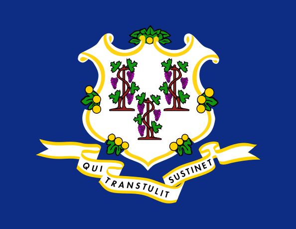 Connecticut
 Delaware
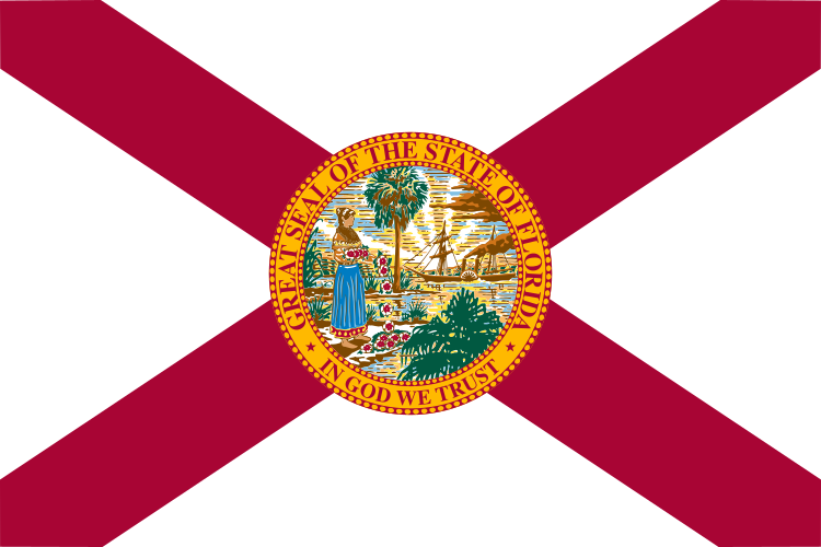 Florida
 Georgia
 Hawaii
 Idaho
 Illinois
 Indiana
 Iowa
 Kansas
 Kentucky
 Louisiana
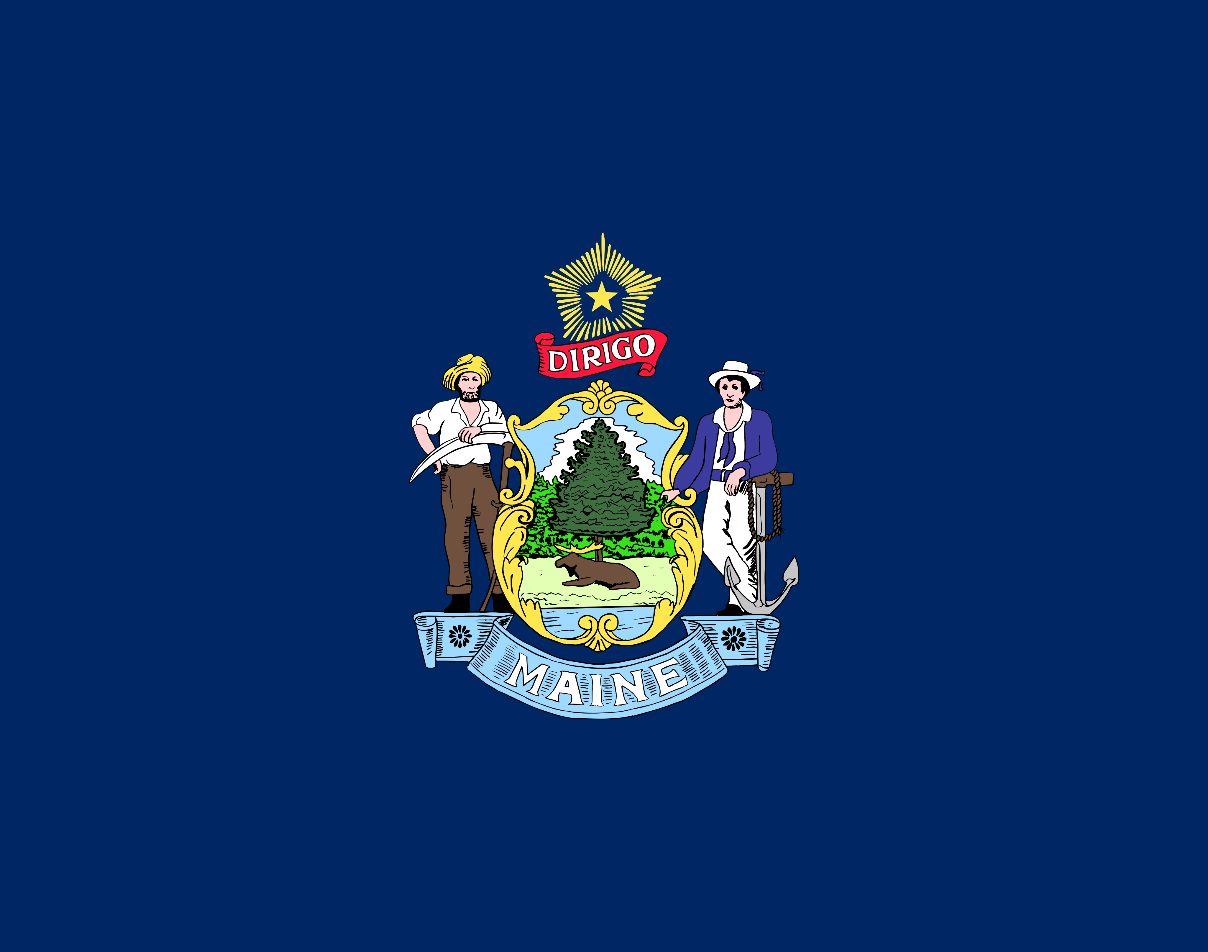 Maine
 Maryland
 Massachusetts
 Michigan
 Minnesota
 Mississippi
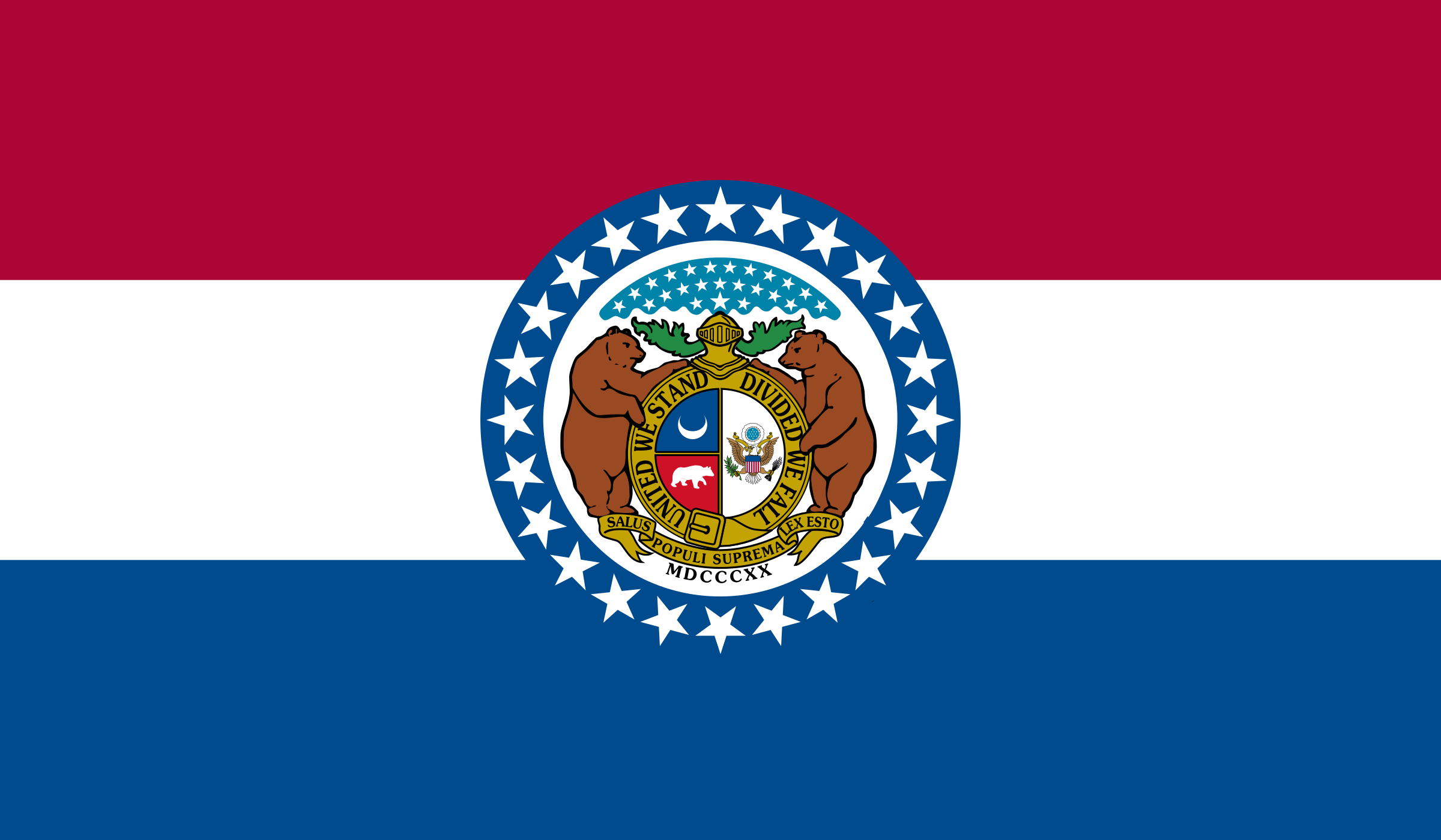 Missouri
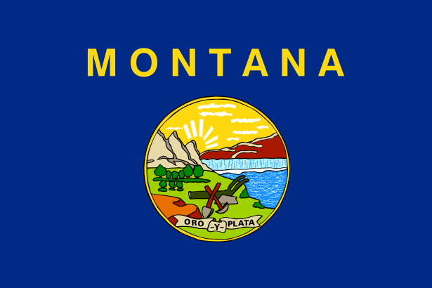 Montana
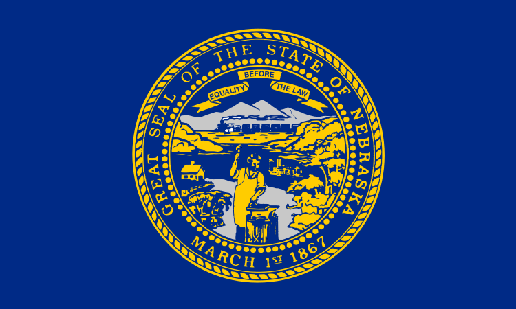 Nebraska
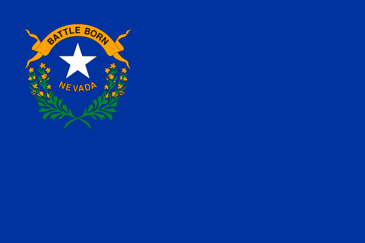 Nevada
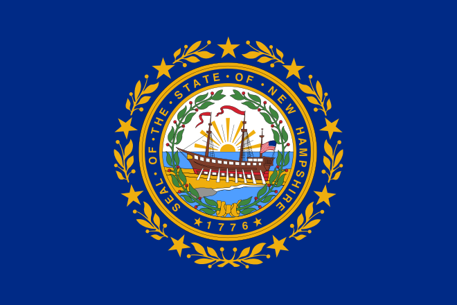 New Hampshire
 New Jersey
 New Mexico
 New York
 North Carolina
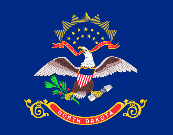 North Dakota
 Ohio
 Oklahoma
 Oregon
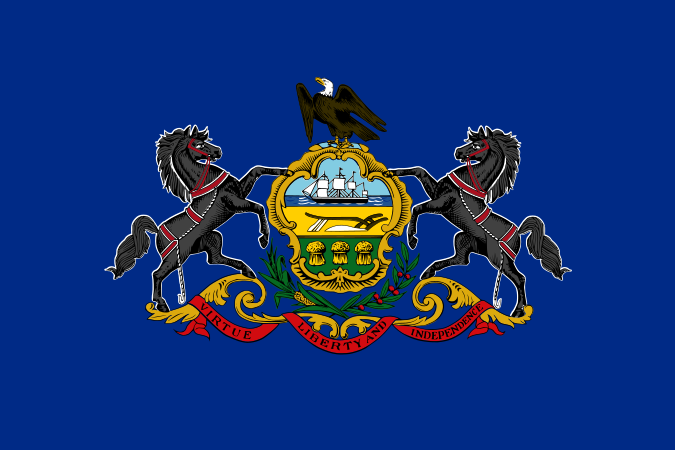 Pennsylvania
 Rhode Island
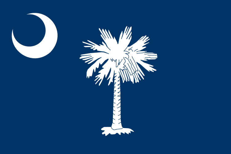 South Carolina
 South Dakota
 Tennessee
 Texas
 Utah
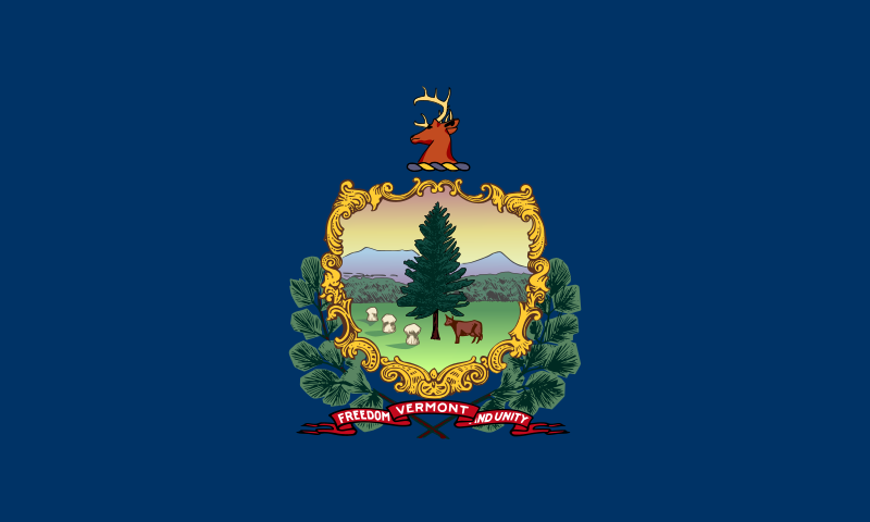 Vermont
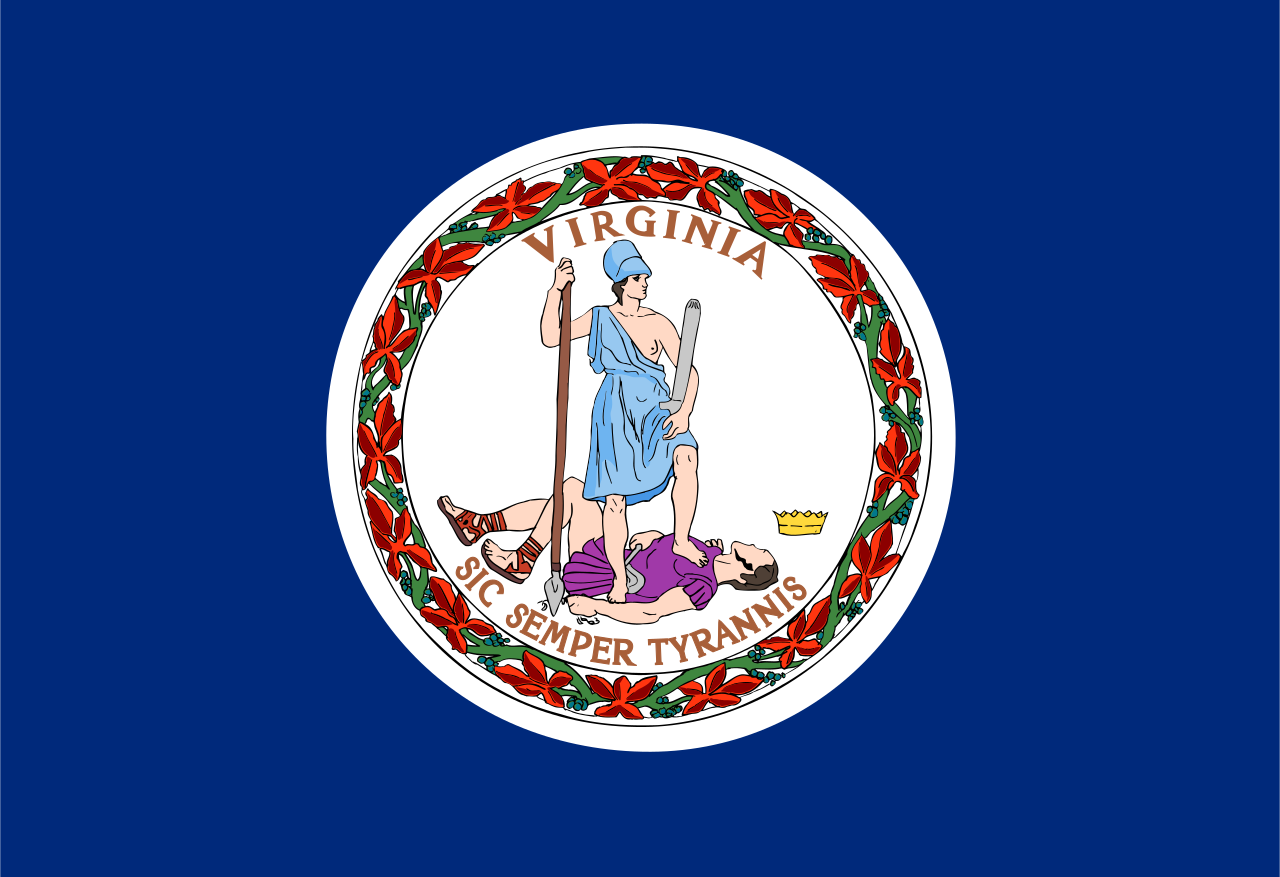 Virginia
 Washington
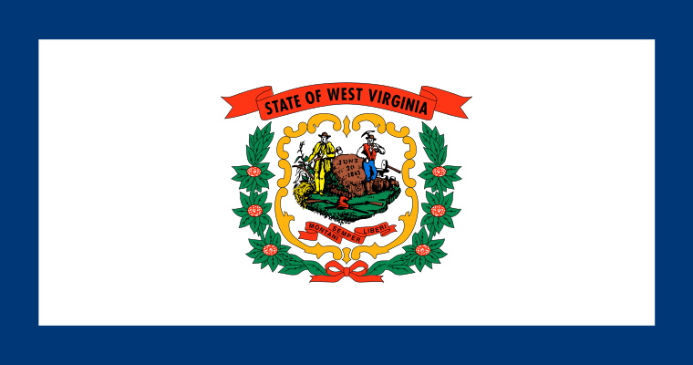 West Virginia
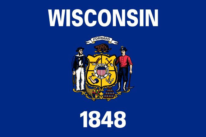 Wisconsin
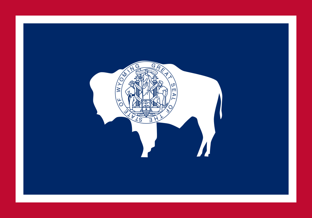 Wyoming